Navigation
Bildinfo und Lizenz
© 2016
- 2026
Bildinfo
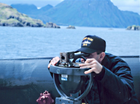
- Orts- und Richtungsbestimmung auf See: Navigation in seiner ursprünglichen Bedeutung
- The ship was launched in 1967, but not fully rigged until 1975. The vessel was again re-rigged in 1982. Miller Freeman was homeported at the Marine Operations Center-Pacific in Newport, Oregon. With a 12,578 nautical mile, 31-day endurance, Miller Freeman was capable of operating in any waters of the world. Miller Freeman carried a complement of 7 NOAA Corps officers, 27 crew members, and maximum of 11 scientists. The ship was decommissioned in 2013.
Source
- Date: Not later than the year 2013
- Author: Captain Robert A. Pawlowski
License
Images in the NOAA Photo Library are in the public domain and cannot be copyrighted. There is no fee for downloading any images on the site. Educational use is encouraged as the primary goal of the NOAA Photo Library is to help all understand our oceans and atmosphere.
Originalseite
- Das Bild ist Teil eines online-Lexikons.
- Rhetos Lernlexikon Mathematik, Aachen:
- Siehe unter 👉 Navigation