Anthropozän
Bildinfo und Lizenz
© 2016
- 2026
Basiswissen|
Was heißt Anthropozän wörtlich?|
Das Anthropozoikum des Antonio Stoppani (1873)|
Der große Faunenschnitt von Hubert Markl (1982)|
Die Idee des Anthropozän|
Verwandte Ideen zum Anthropozän|
Fußnoten
Bildinfo
- Der Mensch hat mit seinen Städten und Straßen den Anblick der Erde im geologischen Maßstab verändert: hier sieht man Frankreich (links) und England (oben rechts) sowie Teile von Belgien und den Niederlanden nachts. Die Licht-Muster erinnern an Strukturen in biologischen Nervengeweben.
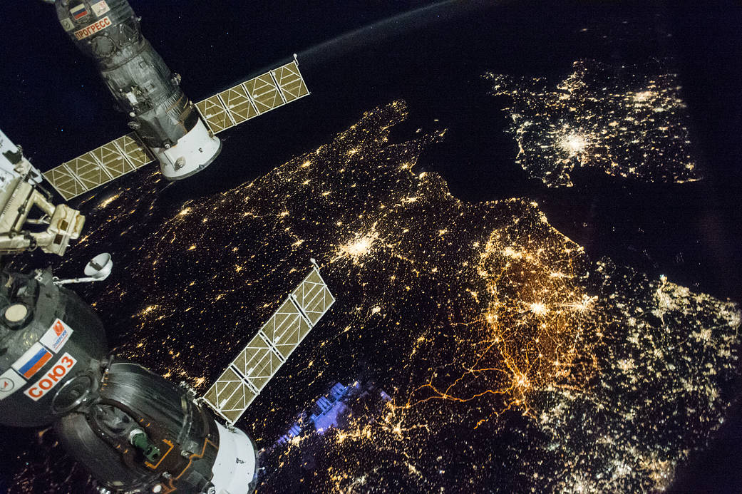
- ss050e012261 (Nov. 28, 2016)
Source
- Created: November 28th, 2016
- Author: International Space Station
- Credit: NASA
License
- This image is from the NASA Imaga Library.
- On the website is the following note:
- NASA content - images, audio, video, and computer files used in the rendition of 3-dimensional models, such as texture maps and polygon data in any format - generally are not copyrighted. You may use this material for educational or informational purposes, including photo collections, textbooks, public exhibits, computer graphical simulations and Internet Web pages. This general permission extends to personal Web pages. [This note was copied from the image gallery site on March 4th, 2020]
Warranty
- No guarantee can be given as to the correctness of facts implied or explicitly stated.
- Usage is completey at your own risk. 💣
Originalseite
- Das Bild ist Teil eines online-Lexikons.
- Rhetos Lernlexikon Mathematik, Aachen:
- Siehe unter 👉 Anthropozän
External images
- Europa, nachts: https://www.nasa.gov/image-feature/western-europe-at-night
- Tagebau, Kippenseite: https://commons.wikimedia.org/wiki/File:Absetzterseite_des_Tagebaus_Inden_2002.jpg
- Handstück, Straßenbelag: https://commons.wikimedia.org/wiki/File:Anthropozän_(Handstück,_Aachen).jpg