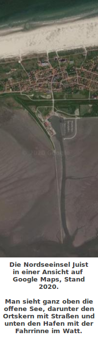
 Man sieht einen Teil der Nordseeinsel Juist.
=> Zurück zum Artikel
Man sieht einen Teil der Nordseeinsel Juist.
=> Zurück zum Artikel
Google Maps
Bildinfo und Lizenz
Bildinfo
- Man sieht einen Teil der Nordseeinsel Juist.
- Die Aufnahme stammt aus dem Online-Dienst Google Maps.
Source
- Author: Ansicht aus Google Maps, 2020
- Date: March 28th, 2020
License
- Auszug des originalen Google-Lizenz-Textes vom July 2022: "As long as you follow these Terms, the Google Terms of Service give you a license to use Google Maps/Google Earth, including features that allow you to: view and annotate maps; create KML files and map layers; and publicly display content with proper attribution online, in video, and in print. ... " Quelle: https://www.google.com/intl/en-US/help/terms_maps
Warranty
- No guarantee can be given as to the correctness of facts implied or explicitly stated.
- Usage is completey at your own risk. 💣
Originalseite
- Das Bild ist Teil eines online-Lexikons.
- Rhetos Lernlexikon Mathematik, Aachen:
- Siehe unter Google Maps => lex ↗